Have you ever wondered why Oklahoma has a panhandle? Why is it called No Man's Land? Why isn't it part of Texas? Why does the southern border of the panhandle align with the southern border of Missouri, Kentucky and Virginia?

The panhandle of Oklahoma was not always part of Oklahoma. It started it's journey to become part of the 46th state when Napoleon Bonaparte sold the land that comprised the Mississippi River drainage west of the river to the United States in 1803.

In 1819, the Adams-Onis treaty ceded the panhandle and other territory to Spain in exchange for Florida. The panhandle lies between the Arkansas River and Red River and the 100 degree W meridian is its eastern boundary.

At the start of 1820 there were 22 states in the Union, 11 free states and 11 slave states. When Missouri applied for statehood it created a crisis since it would break the balance of free vs. slave states. As a solution Maine was added as a free state, restoring the balance. Additionally, the parallel at 36 degrees 30 minutes north latitude became the the divide between new slave states and new free states created from the Louisiana Purchase territory. This parallel was an extension of the southern border of Kentucky and Virginia.
After the Louisiana Purchase, the US viewed the land west of the Mississippi as a place to relocate Indians from the eastern United States. After Louisiana and Missouri became states and Arkansas became a territory, that area shrunk.
In 1830 Andrew Jackson pushed through Congress and signed the Indian Removal Act. This formalized the unofficial policy of relocation and accelerated the rate at which tribes were pushed out of their homeland and moved to what is now Oklahoma and Kansas. From 1830 to 1841 more than 60,000 native Americans were forced to walk from their homelands to the Indian Territory.

In 1836 the Republic of Texas was established by settlers from the
US. It was an independent nation, recognized by the US but not by Mexico. Mexico did not inhabit this part of their territory so when folks
like Steve Austin, Davey Crocket and Sam Houston established
settlements, they effectively controlled the eastern part of what is
today Texas. Additionally they claimed, but did not control additional
territory to the west.
In 1845 Texas was admitted to the union as a slave state with the same boundaries as the Republic of Texas. This created another crisis because a portion of Texas, including the Oklahoma panhandle, was above the 36 degree, 30 minute line.

In 1850 Texas was in a lot of debt after operating as an independent country and fighting in the Mexican American War. As part of the compromise to admit California as the 31st state, the US assumed Texas' $10M debt and Texas had to give up some western and northern territory. This established the borders of Texas as they are today and made the panhandle part of unorganized federal territory.

In 1854 the Kansas-Nebraska Act created the Kansas Territory and Nebraska Territory. This established the southern border of Kansas at 37 degrees north latitude. As more people moved to the Kansas and Nebraska Territories, the Indians were forced out and relocated to the remaining unorganized territory.

By 1879 many Indian Tribes were living in Indian Territory, each governing their own portion of the territory. No Man's Land remained unaffiliated with any organized territory or state.

The Dawes Act in 1887 and later the Burke Act and the Curtis Act phased out Indian ownership of land by 1906, and abolished all tribal courts, giving the US government exclusive jurisdiction.
The 1890 Oklahoma Organic Act created the Oklahoma Territory. Under this law, Indian Territory was subject to the laws of Arkansas and Oklahoma Territory was subject to the laws of Nebraska.
The new Oklahoma Territory included No Man's Land, ending its 40 year run as an ungoverned strip of land.
Seeing the writing on the wall, the tribes of the Indian Territory proposed a State of Sequoyah as a new state in 1905. This was rejected by the US Congresss.

The Enabling Act of 1906 allowed the people living in both Oklahoma Territory and Indian Territory to apply for statehood as a single state.
In 1907, Oklahoma was admitted to the union as the 46th State.
In 1934 the Indian Reorganization Act halted the policies of the Dawes Act and started rebuilding reservations.
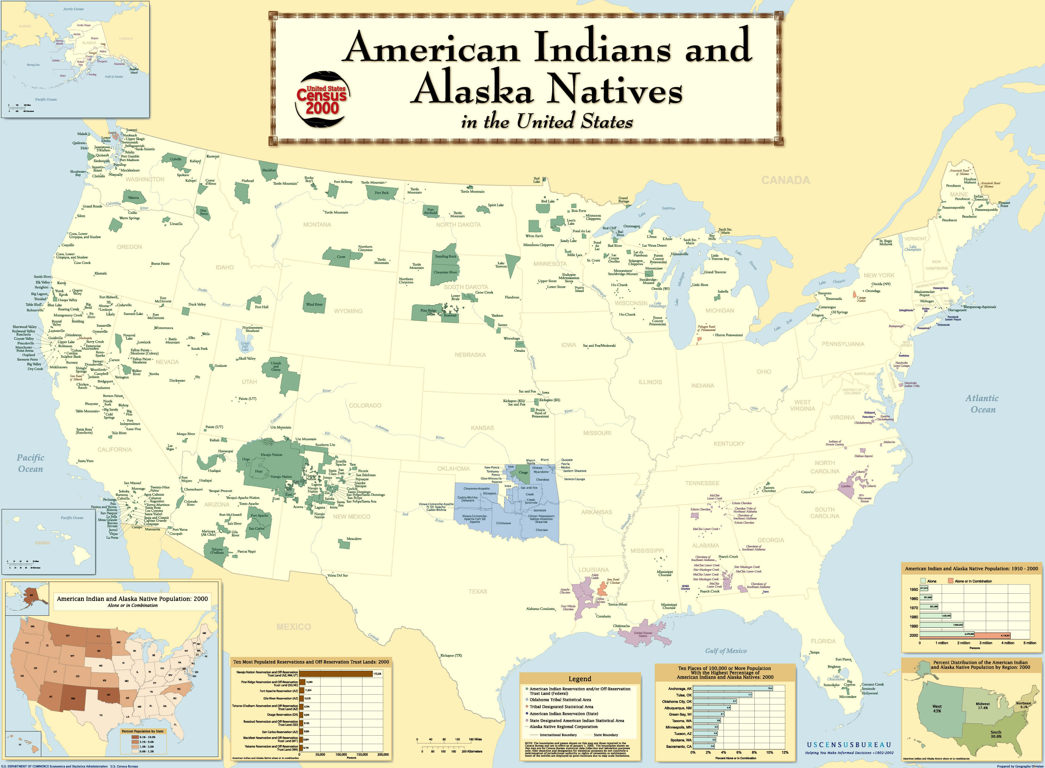
Here is a map of the current (as of 2002) state of Indian Reservation. (click to enlarge)